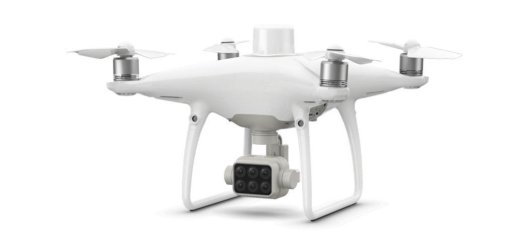
Phantom 4 Multispectral

Plant-Health Data

Multispectral Array
Agriculture imagery collection is more precise than ever with a built-in stabilized imaging system that collects comprehensive data sets. Access information collected by 1 RGB camera and a multispectral camera array with 5 cameras covering Blue, Green, Red, Red Edge, and Near-Infrared bands at 2 Mega Pixels with a global shutter on a stabilized 3-axis gimbal.
Spectral Sunlight Sensor
An integrated spectral sunlight sensor on top of the drone captures solar irradiance, which maximizes the accuracy and consistency of data collection through different times of the day. When combined with post-processed data, this information helps to obtain accurate NDVI results.
View RGB and NDVI
Switch between Normalized Difference Vegetation Index (NDVI) analysis and the live RGB feed to visualize where attention is needed.
Centimeter-level Precision
Get real-time, accurate positioning data on images captured by all six cameras with DJI’s TimeSync system. The TimeSync system continually aligns the flight controller, NB and RBG cameras, and RTK module, fixing the positioning data to the center of the CMOS and ensuring each photo uses the most accurate metadata. All cameras go through a rigorous calibration process where radial and tangential lens distortions are measured. The distortion parameters gathered are saved into each image’s metadata, letting post-processing software adjust uniquely for every user.
D-RTK 2 Mobile Station
Enhanced accuracy of RTK positioning without internet connection by connecting the P4 Multispectral to the D-RTK 2 High Precision GNSS Mobile Station and NTRIP (Network Transport of RTCM via Internet Protocol), or store the satellite observation data to be used for Post Processed Kinematics (PPK).