Pix4D

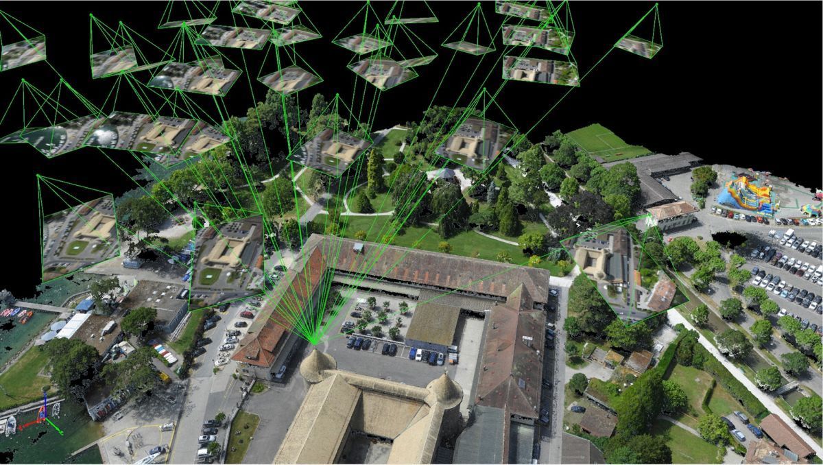
PIX4Dmapper
PIX4Dmapper’s photogrammetry algorithms transform your ariel and ground images to digital maps and 3D point cloud models.
Process projects on your desktop using PIX4D photogrammetry software, or bundle with PIX4Dcloud for online processing.
Mission Flights
Capture thermal, RGB, or multispectral images with any camera. Using a drone, automate flight and transfer image data with the PIX4Dcapture app.


Quality Report
Assess the accuracy and quality of your projects.
Flyability Elios 2 & Pix4D
A bundle is now sold in a Photogrammetry Add-On that can be purchased on top of Elios 2 drone packages. Thus, Pix4D facilitates access to a coherent and complete product offering, to those who want to utilize indoor 3D modeling using photogrammetry.
Barrick Gold Corporation Uses Elios 2 and Pix4D
What was once thought to be impossible is now possible with the Elios 2 Indoor Inspection Drone and Pix4D Photogrammetry Software. Not only does the Elios 2 prevent danger or potential hazards to employees, but also saves time and unnecessary damages or loss to mining equipment. Barrick Gold Corporation was able to generate an entire photogrammetry map of their project using an Elios 2 with Pix4Dmapper to calculate the danger to miners, the risk to equipment and potential loss of ore.